Vía Serrana Diary

The Vía Serrana is a 240km Camino de Santiago route beginning in La Línea (the Spanish town adjacent to Gibraltar) and ending in Sevilla. It takes in many of the highlights you would expect to find in Andalucía, from historic cities to whitewashed towns and Mediterranean landscapes dominated by olive groves. 

For me, the Vía Serrana was ultimately not marked by any of these things, however, but instead by an emotional phone call from half a world away that became the indelible memory of this camino.

This is my day-by-day diary from the Vía Serrana.

A pre-dawn departure for my first day on the Vía Serrana, but that’s not saying much when sunrise is at 8:11am. I leave about half an hour before then under clear skies and, after my dalliance with Tau waymarking signs on the Via di Francesco last month, I’m back to following yellow arrows again. 

The highlight of the stage comes early on, as long as you remember to turn around from time to time. After leaving La Línea, there are great views back to the Rock of Gibraltar silhouetted in the early morning light — and beyond to coastline of Africa. 

Looking forward again, it’s mostly dry, parched scrubland for 8km to San Roque, the only town during the stage and the first of what I assume will be many almost blindingly whitewashed settlements on this camino. 

After San Roque, it’s about 19km of rural walking where you see barely a soul, save the odd donkey or goat. The vegetation ranges from outrageously colourful orange flowers set against the deep blue sky, to the much more common — and poignant — dead thistles that dominate the late November landscape. The walk is mostly shadeless but a pine forest or two offers the chance for a picnic lunch out of the sun.

San Martín isn’t anything special but it’s not a bad spot to watch local life go by in a nondescript place, as the guide books would say. In the late afternoon I see two men sitting at an outdoor café in the centre of town holding the reins of their two horses who are just hanging out on the street, and I think to myself: this is going to be an interesting camino.

The initial part of today’s stage is through a wind turbine park, which takes me back to my first trip to Spain in 2001, when I saw wind turbines for the first time.

But not this close. To walk right next to them today, to see how they tower above you and to hear the woosh of the blades slicing through the air — well, it’s quite impressive. Now that many European countries are facing energy shortfalls this winter, I wonder how many people’s first impression of wind turbines is still that they are a blot on the landscape?

The rest of the stage is short and sunny, if unremarkable. It’s slightly greener than yesterday, with more shrubs and almost no dead thistles. By noon, I’ve already arrived at my destination.

Jimena de la Frontera is the first historic town of this camino, and it’s to visit places like this that I’m here in the first place. The whitewashed town shimmers on a hillside, topped by a medieval castle that rises high above the tiled rooftops and almost blends into the arid landscape that surrounds it. As I stop at a restaurant in town, the first song playing is ‘Walk of Life’ by Dire Straits, which makes me smile.

I eat a tajine for lunch and then explore the Islamic elements of the castle, with goats roaming around the fortifications. If I squint, this could almost be Morocco.
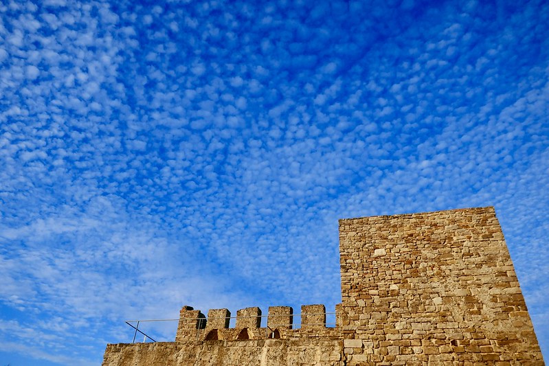
Rain. 

It rained through the night and it’s pouring when I wake up this morning. I’m more anxious about walking in the rain than I should be, but that’s because up to now I have somehow walked 70 days on camino in 2022 without needing to wear my poncho once while on the trail. Including in Galicia.

I wait until sunrise, and then a bit longer, and soon the rain eases off and becomes just a drizzle — almost light enough to not require a poncho, but not quite. I put it on and set off, and the rain is pretty light to begin with and gets lighter before stopping for good in the late morning, so it‘s not that bad after all. The camino is a mixture of asphalt roads and dirt paths, and the former is actually better because the latter involves mud, and therefore mud-caking. 

It’s foggy even when the rain stops, so there’s not much visibility. After San Pablo de Buceite, the trail passes avocado plantations and then climbs into the hills for what I suspect would be, on a clear day, the best scenery on the Vía Serrana since the Rock of Gibraltar disappeared from view. Even without views, and despite the mud, it’s nice walking. As I approach El Colmenar, the visibility is better and I can see some of the rock face of the Cañón de las Buitreras — which awaits tomorrow — in the distance. 

The forecast called for more rain tomorrow, but it changes seemingly by the hour and now it looks like it might even be sunny. So I’ll take a day like today and even one or two more if the trade-off is a sunny day through the canyon. 

Gently sloping, forested hills are quickly transformed into sheer, dramatic cliffs. Early morning beams of sunlight pierce the crags only to vanish into the vast expanse of the valley floor far below. Birds of prey soar high above, ominously circling at first, then making majestic sorties from the mountaintop. Defying the sunshine and blue sky, fog rolls through the narrowest stretch of the gorge, infusing magic and mystique into the landscape. The thunderous rapids of a fast-flowing river provide the only soundtrack. It’s utterly spectacular, and no one else is here. 

It’s the Canyon of the Vultures.
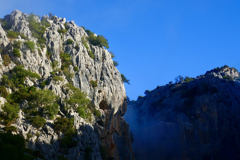
It’s foggy when I leave Jimera in the dark this morning but I don’t mind, as I know a nice day is out there somewhere, and the trail is a joy to walk on. It’s a path cut into the mountainside, wide and mud-free. I come across a herd of sheep on the path, and they take one look at me and scatter, dashing up the mountain.

By the time I reach Estación de Benaojan, the fog starts to lift, the sky turns blue and the surrounding landscape is revealed for the first time: olive trees and golden wheat fields framed by mountains, or, in other words, the Andalucían countryside that I’m here for. The next section of the walk is hilly but beautiful, and the first, distant glimpse of Ronda — a city built on cliffs — is breathtaking. 

It’s the first time I’ve been to Ronda and the city is extraordinary: medieval gates and walls, whitewashed buildings, soaring church towers, Islamic remains and, most famously, a dramatic gorge that somehow runs right through the centre of the city. There are blue skies above when I arrive and, later, spectacular storm light as dark grey clouds roll in. 
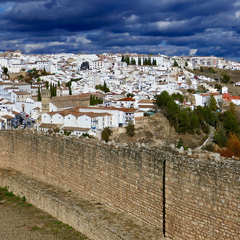
Overall, this is the best day on the Vía Serrana so far. The trails are great for walking, the scenery is gorgeous (despite not reaching the heights of yesterday’s canyon) and Ronda is a special place to end the stage. 

Ronda also marks the halfway point of this camino. After the fabulous last couple of days, what else does the Vía Serrana have in store for me?

I would have gladly stayed an extra day in Ronda but I don’t have time and instead leave under the cover of darkness this morning. The weather is either hazy (according to my weather app) or raining (according to what it actually is when I step outside). But it’s very light rain and in any case it stops in a few minutes, giving way to the morning fog which has become common in the last few days.

After some asphalt road walking to begin the stage, the camino soon evolves into pleasant dirt paths through the countryside and the sun peeks out every now and then. I see olive groves on a mass scale for the first time on this camino — those distinct green leaves set against a stormy grey sky — and an occasional late autumn vineyard in yellows and reds.

Towards lunchtime I make a detour to the archeological site at Acinipo, which adds about 5-6km to my day. Fortunately, it’s worth it for the 1st-century BC Roman Theatre, which retains an impressive stage backing in addition to seating carved out of the rock. Because of their engineering capacity and eventual mastery of concrete, the Romans didn’t need to build their theatres into hills the way the Greeks did, but they did in this case and seeing it is the highlight of the stage.

Soon after leaving the theatre I get my first tantalising glimpse of Olvera – whitewashed, dramatically set on a hillside, surrounded by olive groves … and 15km away. Reaching it is a slog, often on paved roads and under an overcast sky, and I arrive with only half an hour of daylight left. When I get there, light drizzle is falling again, the bookends of my day.

Five minutes after setting out in the dark this morning, I receive a teary phone call from home with news of a serious medical diagnosis in my family*. A few minutes later, shaken and trying to process what I’ve heard, I turn around to see the sky lit up and I take this photo, because what else can I do? Besides, one sunrise represents the promise of many more to come.
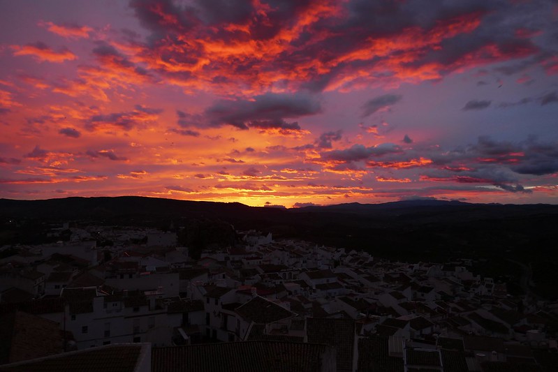
I walk with a heavy heart and some more tears but the camino is therapeutic, even though it’s gloomy and drizzly and I don’t care much for olive groves or griffin vultures today.

The one thing that does resonate with me is that the entire stage unfolds on a 19th-century railway line that’s cut into the mountains. The track was never completely finished but most of the infrastructure for it was built and it remains to this day.

The point is: on the very day when I’m trying to see the light at the end of the tunnel, it’s remarkable and reassuring that the camino takes me through 20 actual tunnels — and that there’s light at the end of all of them.

* Update: the treatment was successful and the danger has passed, for now.

There hasn’t been much sunshine — literal or figurative — in the last two days. On the heels of yesterday’s family news, today I find out about the passing of the father of one of my best childhood friends.

All there is for me to do is walk, but there’s no sunshine there, either. It rains on and off in the morning, and it’s foggy and muddy. After Montellano, the mountains are replaced by plains and the camino is on a busy road, both of which render the Vía Serrana unrecognisable. I feel that the best of this camino is behind me now, and that I’m not in the right frame of mind to enjoy whatever’s left.

And then it happens. The sun finally comes out for the first time since Sunday morning, and it warms my bones and my heart. Then, a 14th-century Arab castle appears out of nowhere just off the road just 3km from the end of the stage, and I hasten to it while the sun’s still out.

I climb the crumbling towers, take in the sunshine from atop the ramparts, and, for the briefest of moments, I don’t have a care in the world.

Camino arrows are a bit like life: both can be crooked sometimes, but in the end they point you in the right direction.

Today that direction is towards Utrera, the last major stop before Sevilla. It’s a flat, muddy path through brown fields but there’s some sunshine in the morning and I’m happy to be walking. I turn around and see the mountains disappearing in the distance and think about how far I’ve come.

At Los Molares, a construction worker stops me to ask if I’m walking the camino. When I say that I am, he enquires about my stages and distances, we chat for a minute, and his interest brightens my day. He wishes me a buen camino, only the second time anyone has done that on the Vía Serrana.

Utrera feels like a mini-Sevilla and it’s nice to walk through its charming alleyways on the way to my accommodation. It’s gloomy by the time I arrive and rainy later on, but that means I don’t have to be a tourist and instead I can rest ahead of my final day tomorrow. Because from the looks of things, I’ll need it!

For the final act of the Vía Serrana today, I’m faced with a 34km stage in the rain. I almost skip it and take a 30-minute train ride from Utrera to Seville instead, because how much fun is it going to be to walk 34km in the rain? 

But having fun isn’t why I’m walking this camino anymore. The pilgrimage has been stripped down to its most basic, persevering form: putting one foot in front of the other.

So that’s what I do today. After three hours of off-and-on drizzle in the early morning, biblical rain arrives and there’s nowhere to hide on the open plains, so I get drenched. By the time I reach the outskirts of Alcalá de Guadaira, the streets have become rivers and waterfalls are cascading down staircases.

The rain eventually stops and Sevilla arrives more quickly than I thought, but it takes a long time to make it through the outskirts. Then I’m in the centre and it all comes at once — Plaza de España, the Universidad de Sevilla (where I once attended a paleography colloquium), the Real Alcázar, the cathedral. Suddenly the Giralda is soaring above me, I’m back to where I began, and it’s over.

I don’t know what to feel, but mostly I’m just exhausted. I take the same photo I took before starting out on this camino, yet it’s somehow completely different. It’s dull and gloomy and looks pretty much like the last four days have felt. 

But I don’t want that to be my last memory of this camino, so I go back 90 minutes later at nightfall and take the same photo for the third time, with lights and bells and whistles. It’s the brightest one of them all, and that’s how this journey ends.

Portuguese Coastal Camino Diary

The Portuguese coastal route is the third most popular Camino de Santiago trail after the Camino Francés and the Portuguese Central, according to 2022 statistics from the Pilgrim Office in Santiago.

But does walking a non-traditional, scenery-based path along the coast still feel like a Camino de Santiago? That’s the question I asked myself as I walked on the Portuguese coastal route from Porto to Vigo in the middle of the beach holiday season.

In keeping a daily diary of the pilgrimage, I eventually found my answer.

One of the famous boardwalks of the Portuguese Coastal route.

Day 1: Porto to Vila Chã  — 26km

A pre-dawn departure from Porto and it’s exciting to be back on the camino and to walk through a virtually empty city after it was bursting at the seams with tourists yesterday afternoon.

I take the alternative river exit and I’m glad I did, even though the absence of arrows at the outset of a camino is slightly disconcerting — not for wayfinding, because that’s quite obvious, but because it doesn’t help you land on the right side of ‘Does this feel like a camino?’ when there are no arrows. But soon I pass three Italian pilgrims and we exchange ‘bom caminhos’, and a camino it is.

Where the river meets the ocean at Foz do Douro is my favourite part of the stage, because there are lighthouses and fishermen and a surprisingly interesting fort to explore all to myself (not to mention the fabulously-named Instituto de Socorros a Náufragos — something like the ‘Shipwreck Rescue Institute’). Foz feels like a real place, unlike Matosinhos, which comes soon enough and is quite the shock. 

There are beaches by now and it’s August so they’re jam-packed with holiday-makers, even though the beaches aren’t especially nice and are surrounded by industrial cranes and silos and ugly modern buildings. The beaches and umbrellas and people and development seem to go on forever, and by 9:15am I’ve already seen two Pizza Huts and this isn’t the Portugal I know. But there are arrows and a Lidl in Matosinhos so I take those little wins, stock up, and move on.

Then the boardwalks begin and the rhythm for the rest of the stage is set. Walking a camino on wooden planks is new for me and not my preferred surface but it’s still pretty easy walking because it’s not hot and you can’t exactly get lost on boardwalks. As I approach São Paio the holiday crowds start thinning out a bit and it seems more low key and there’s a nice estuary full of bird life, all of which is more to my liking. 

Before I know it, I reach my destination, the fishing village of Vila Chã, and it’s not even 2pm yet and if that was really 26km, it was as much of a breeze as the one coming off the ocean.

Sunset at Vila Chã at the end of my first day on the Portuguese Coastal route.

Day 2: Vila Chã to Esposende  — 31km

I leave at dawn this morning but sunrise is merely theoretical because it’s misty and overcast and it will remain that way (at least the overcast part) for all of today’s 31km. It’s the longest day I’ll have on this camino, and some might say it’s ‘perfect hiking weather’, but I’m not one of them, and I miss yesterday’s glorious sunshine.

After Vila Chã ends, the boardwalks begin but they can hardly be further from the ones that were packed with beach-goers yesterday. The boards are damp from the mist and visibility is poor and there’s an almost complete absence of people. I don’t see any pilgrims and hardly anyone at all until Vila do Conde, just the odd local jogger or dog-walker. I signed up for a solo camino and this morning I get one; after yesterday’s beach crowds, I enjoy the solitude.

Vila do Conde has a nice historic core with some old sandstone buildings and azulejos and although I’ve never been here before, it’s a familiar and welcome version of Portugal for me. The Igreja Matriz is closed but it has a magnificent late Gothic Manueline portal, so I stop in the square opposite (also familiar: Praça Vasco da Gama) and eat breakfast.

It’s only 9am when I leave Vila do Conde but I don’t have my camino legs under me yet and I feel sore already, barely a third of the way through my stage. Pushing on, Povoa do Varzim has a nice church half-dedicated to Santiago with an azulejo of the saint and quite a few people praying inside, but after that the town descends into today’s most touristy beach spot. After lunch, there are more boardwalks, a golf course, a vineyard or two (literally), almost a pine forest, no pilgrims, and plenty of cobblestones. If anything makes you long for boardwalks, it’s cobblestones — but it wouldn’t be a Portuguese camino without them.

Apúlia seems like a ghost town but the Igreja Matriz is open so I go in and I’m the only person there and I’m surprised by how much I like it. The interior artwork is all modern, which doesn’t usually do much for me, but I find the mosaics to be quite fascinating. There are four of them and they’re almost all black-and-white but each has a splash of a different colour that illuminates them and brings out each scene, and I’m happy with this little discovery.

By Fão I’m near the end of the stage, but I’m worn out so I stop at a bar for a drink and chat with two pilgrims for a while. We walk together for the last 2.5km to Esposende, where we’re all staying tonight (albeit in different places), and it’s good company.

The day finishes happily with pizza and cider on a nice square, so if this ends up being the least interesting stage on this camino, then I’ll take it.

One of the unusual mosaics at the church in Apúlia showing the baptism of Jesus.

Day 3: Esposende to Viana do Castelo — 25km

Early morning fog — again! — but thankfully it doesn’t last today. By about 8:30am, the sun breaks through and it turns into a beautiful day, and an easier one than yesterday for a solar-powered pilgrim. 

One of the quirks of the ‘coastal’ camino is that a fair bit of it is not by the coast at all — that’s what the Senda Litoral is for — and the official route today between Esposende and Viana do Castelo is entirely inland with not a single boardwalk after the outskirts of Esposende.

The early part of the day is fairly unremarkable (towns and cobblestones) and I am lost in thought when I suddenly realise, about three hours into the stage, that I’m in a forest for the first time on this camino. It’s not the most amazing forest I’ve ever been in by any stretch of the imagination and it only lasts a few minutes and there’s a fair bit of eucalyptus, but despite all of that, I irrationally love it. There’s actual terrain and I can feel the earth under my feet and hear the flow of a nearby river, and this is what the camino is for me. The river crossing over a stone bridge is nice and although there’s an opportunity just after the bridge to head towards the coast, I stick with the inland route and am rewarded soon enough with another forest, which is not quite as thrilling as the first one but worth it all the same.

It’s also another day of churches and there are several on the trail that I like: Belinha for its quasi onion dome, rare in Portugal in general but somewhat common in this part of the country; Castelo do Neiva for its AD 862 inscription that shows it to be the earliest known sanctuary to Santiago outside Spain; and Anha for more surprisingly interesting modern art, this time stained-glass windows.

I arrive in Viana do Castelo by 2:30pm; it’s an attractive town with a picturesque historic centre, and it’s a good place to reflect and ponder over an afternoon drink at a garden kiosk. If the lesson from today is ‘the further inland you go, the more authentic a camino this is’, what does that mean for the coming days?

A Roman Road through the forest.

Day 4: Viana do Castelo to Caminha — 27km

Walking through an empty Viana do Castelo at dawn, with an orange tinge in the eastern sky and not a cloud in sight, the decision point comes early today. The official ‘coastal’ route is once again mostly inland, and there’s an obvious Senda Litoral alternative immediately after Viana that hugs the ocean. Despite my enjoyment of the interior route yesterday, today’s stage doesn’t sound exceptional, so I opt for the Litoral and I’m glad I did.

Early on, the coast is wild and rough, and, while it’s not exactly beautiful, I like it. Gronze describes today’s Litoral alternative as ‘sin flechas pero con playas’, but that’s only half right for the first 10 kilometres: there are no arrows, but there aren’t any beaches either. Instead, the coast is rocky and locals clamming outnumber sunbathers — and pilgrims — for the first couple of hours. The winding dirt path passes four mills (one recently restored, three not) and a couple of forts, and this is my favourite part of the day. 

Later, the beaches appear and I take my shoes off and dip my toes into the (freezing) sea for the first time on this camino. Vila Praia de Âncora is the unappealing beach town of the day, where the coastal and Litoral paths meet back up, and I pass through quickly. 

At Moledo, near the end of the stage, arrows take pilgrims onto the highway but I follow a recommended Gronze alternative and find myself in a sandy pine forest that resembles the Camino de Madrid except for the sound of the ocean to my left. When the forest ends, the body of water in front of me is no longer the Atlantic Ocean but the Minho River, and the land I can see on the other side is Galicia.

One of the mills on the Senda Litoral.

Day 5: Caminha to Oia — 16km

Sunrise over the Minho River affords one last glimpse of Portugal before I am whisked across the river by boat with three other pilgrims to continue my journey in a different land; on the other side of the river, which is now the Miño, awaits Spain. 

Two minutes after disembarking from the boat, I’m taking a photo of a building by the shore whose faded grandeur is lit up by the sun’s first light, and a local man walks by and asks if I speak Spanish. When I say that I do, he tells me that the building was used as a concentration camp during the Spanish civil war. I look it up later and he’s right; according to one account I read, in just two months in the summer of 1938, 171 people were executed there. Later, I find out that the Oia monastery was also a concentration camp during the war.

The camino itself is different in Spain, too: right away there are hills and forests and mojones showing the distance to Santiago (165km), standard practice in Galicia but something I had almost forgotten about while walking in Portugal — especially on the Senda Litoral, where there aren’t even arrows, let alone distances.

After A Guarda, the coastline is rocky, like yesterday, but it’s more remote. Hills rise up directly from the ocean at times, leaving few settlements and forcing the camino away from the shore, sometimes onto the highway. It might not be the best day of walking but it’s a short stage and it’s sunny and I’m happy to be in Spain. 

By midday I’m already in Oia, and that’s as far as I’m going today because I want to visit the monastery and align my stages for Baiona and Vigo over the next two days. As I arrive, a localised fog descends on the ruined monastery by the sea, and, as improbable as it may seem at times, right now it doesn’t take much imagination to picture a Celtic land on the Iberian peninsula.

Fog descends over Oia and its famous monastery.

Day 6: Oia to Baiona — 18km

I leave Oia in heavy fog, which lasts all morning and then some, but I don’t mind because I’m nearly at the end and this is Galicia and it’s real. The glamour of the boardwalks and packed beaches and Pizza Huts of just a few days ago seems a long way away now, as I walk alone alongside a remote, rocky and misty coastline and can’t even see the water at times. Yet I prefer this — for the solitude, the sense of exploration and discovery, and, yes, because it feels more like a camino.

I have an unusual goal today and there’s not much in the fog to distract me from thinking about it. About 12km into the stage, I forego the arrows urging me inland and stay on the coast for another half an hour to reach the ‘beach of the crystals’, which I only know about because another pilgrim came this way a couple of weeks ago and wrote about it. The crystals are, in fact, small pieces of sea glass, of various colours but mostly clear and green, smoothed and frosted and scattered all over this tiny beach. It’s quite fascinating, and I stay for a while, eat a cobbled together Sunday lunch consisting of gas station snacks, and look past the crystals out into the ocean as far as the eye can see — which is not very far on a day like this.

Sea glass from the ‘beach of the crystals’.

After I leave the beach, the fog that has lingered all day completely clears in 10 minutes, the Galician coast suddenly reveals itself, and my destination, Baiona, looms in the distance. I walk for an hour in the sun and reach my albergue, but by the time I have a shower, rest, and am ready to go out and explore the castle, the fog is back and I can barely see the crenellations. 

‘It comes and goes,’ the hospitalero says matter-of-factly about the fog, and people seem to barely notice it as they continue to take their Sunday afternoon strolls and lay out on the two small city beaches. But I can’t help but think about what an odd existence this must be, having your town literally disappear from view for hours at a time, at any time of day, in the middle of summer. 

And just as I’m writing this on a park bench in the fog at 8:30pm, the sun breaks through, the sky turns blue out of nowhere, I get my photo of the castle, and all is right with the world.

The castle at Baiona in the late afternoon sunshine.

Day 7: Baiona to Vigo — 25km

It’s foggy again as I set out this morning but it isn’t nearly as thick as yesterday, and at this point the fog has become an inseparable part of this camino — and of this mystical land. By 11am, the fog clears and it’s sunny for the rest of the walk.

This is the last day of my camino, and that’s usually accompanied by a sense of excitement at approaching Santiago. But today I’m only going to Vigo, a large and unattractive city whose best feature might be its good transport connections with Lisbon. On one hand, this will be a somewhat anticlimactic end to this little camino; on the other, I can enjoy the walk without being consumed by my impending arrival, because, really, I don’t want to arrive. And I’m not the only one; at one point today, I see a pilgrim laying on the beach, propped up by her backpack, reading a book.

From A Ramallosa, I take the coastal variant, as do quite a few others. It’s a nice path, passing a few local, low-key beaches and some cruzeiros to remind me where I am.

One of the coastal cruzeiros on the trail between A Ramallosa and Vigo.

As I approach Vigo in the early afternoon, the city is fortunately hidden by coves and bays and I don’t actually see it until I’m basically in the outskirts. And then I have to walk through an urban jungle for an hour, but it’s not bad and there’s some street art to look at and before I know it, I’m at my accommodation and my camino is over.

As for the question I’ve been pondering throughout this pilgrimage — ‘Does this feel like a camino?’ — I think the answer lies inside each individual pilgrim more than anywhere else. If you take the Senda Litoral at every opportunity and stay overnight in the touristy beach towns, I suspect it doesn’t feel much like a camino. And if you’re just here for the ocean, you’d be better off on the Rota Vicentina, which is both more remote and more spectacular.

But if you look for the camino here, you’ll find it — in the monastery of Oia, where monks fired canons at pirates from the patio that also served as the pilgrim route; in the ninth-century church inscription mentioning Santiago in Castelo do Neiva; and in those quintessential and special markers of Galician culture: the cruzeiros and the shells and the hórreos and, yes, even the fog.


For more content on the Portuguese Way of the Camino de Santiago, check out our other posts and resources:

Portuguese Way Highlights | Portuguese Way Experiences | Variante Espiritual Highlights | The Camino de Santiago in Portugal | Podcast Season 1

Camino Inglés Highlights

The Camino Inglés (‘English Way’) is an increasingly popular short route of the Camino de Santiago that winds its way south from the north coast of Galicia — where boats would drop English pilgrims in medieval times — to the tomb of the apostle in Santiago de Compostela.

A 113km journey from Ferrol that is usually completed in five or six days, the Inglés is an excellent alternative to the more crowded last 100km of the Camino Francés or Camino Portugués.

And a pilgrimage on the Inglés might just get you hooked, like the Italian pilgrim and self-proclaimed ‘King of the Camino’ we met who was walking the route for the 12th time.

So, what makes it a charming little camino? Our six Camino Inglés highlights offer an explanation.

Camino Inglés Street Art
A pilgrim mural at the beginning of the Camino Inglés in Ferrol.

Celebration of Galicia

All Camino de Santiago routes are, in a sense, defined by the region or regions they traverse. To take the most obvious example, the Camino Francés is marked by its journey across northern Spain, taking pilgrims over the Pyrenees, into the Basque country of Navarre, through the vineyards of La Rioja, alongside the endless fields of the Meseta, past the stone villages of El Bierzo and finally through the forests of Galicia.

As a short camino, the Inglés cannot match the Spanish kaleidoscope of the Francés or other longer routes, but instead offers a celebration of a single region: Galicia. In just a few days of walking, all of the cultural touchstones of Galicia can be appreciated, including hórreos (traditional raised granaries), galerías (winter garden window frames marked by white borders), cruceiros (sculpted stone crosses) and local dishes such as polbo á feira (Galician-style octopus). 

Hórreo
A typical Galician hórreo on the Camino Inglés.

In addition to its cultural elements, Galicia’s natural features shine on the Camino Inglés, starting with its incredible greenery and, in springtime, the explosion of colourful wildflowers on the entire route. Beyond Galicia’s trademark forests, the Camino Inglés also takes pilgrims along the coast at times, from the Ria de Ferrol estuary to start the pilgrimage to the beaches at Magdalena and Grande de Miño.

In short, the Inglés is an excellent option for pilgrims without much time who are looking to immerse themselves in Galicia. 

A Coruña 

Of the two branches of the Camino Inglés, the one beginning in A Coruña is less popular because it doesn’t meet the 100km requirement for a compostela, unless it’s combined with another recognised walk in England or even the United States. Starting in Ferrol solves this problem, but Ferrol itself is a fairly nondescript place to begin a camino, and pilgrims are advised to make the effort to visit A Coruña beforehand to experience a more dynamic northern Galician city. 

Among the highlights of A Coruña are the region’s most famous and photogenic galerías along Avenida Marina and the windswept Torre de Hércules lighthouse, one of the symbols of Galicia. 

Galerias A Coruña
The dazzling white galerías of A Coruña.

Beyond these major attractions, the church of Santiago offers a symbolic starting point for the camino — and a more appropriate one than the tourism office in Ferrol. At the wooden statue of Santiago inside the church, pilgrims can summon the strength and spirit they will need for the journey ahead.

In our view, A Coruña sits comfortably in the middle range of the seven cities of Galicia in terms of tourism appeal: below Santiago and Lugo, on par with Pontevedra and Ourense and above Vigo and Ferrol.

Street Art

An increase in street art has become a feature of many caminos in recent years, and the Inglés is particularly rich in this regard. Designs range from an epic confrontation featuring Neptune and Hercules in A Coruña to portraits of prominent local citizens in Miño.

But it’s the camino-themed street art on the Inglés that is the most memorable, not least because it serves to animate and encourage pilgrims on their arduous path. This begins precisely at kilometre zero, as a large pilgrim mural adorns the exterior wall of the tourism office in Ferrol. 

Further along the Inglés, Santiago the pilgrim is a common subject for street art, but the most striking piece, created by Victor Romero Toscano in a tunnel in Narón, shows an octopus wrapped around a way-marking mojón and a pilgrim staff with a shell and traditional water-carrying gourd tied to it. 

Octopus Street Art
One of the outstanding pieces of camino-themed street art on the Camino Inglés.

Finally, while not strictly street art, an unmissable attraction — and well-deserved rest stop — in Presede is the Mesón-Museu Xente no Camiño, a café decorated with distinct, starry paintings, many of which are related to Galician culture or the camino. 

Boo!

One of the pleasures of the camino is learning about local history in places that you might not ordinarily visit. The Inglés is no exception, especially regarding one figure in particular: Fernán Pérez de Andrade, known charmingly as O Boo, derived from a Galego epithet meaning ‘the good’. 

Boo was a 14th-century Galician knight who, it is said, built seven churches, seven monasteries, seven hospitals and seven bridges. While these figures may be exaggerated, Boo’s fingerprints are all over the middle stages of the Camino Inglés, where seemingly every second bridge or church you pass is attributed to him. 

He is also the subject of an unusual memorial cruceiro at Ponte do Porco that includes a sculpture of a wild boar, the symbol of his house. Finally, Boo’s tomb is the star attraction at the church of San Francisco in Betanzos and, naturally, this has been turned into a dazzlingly colourful piece of art at the aforementioned Mesón-Museu Xente no Camiño in Presede.

Betanzos

With two of the seven cities of Galicia in close proximity to each other on the north coast of Galicia, and Santiago not far further south, there isn’t much room left for historic towns in between. Fortunately, there is one major exception to this rule: Betanzos.

For the energetic pilgrim, the hilly streets of Betanzos are littered with churches and monuments that make for a wonderful afternoon’s exploring. Pilgrims access the town by crossing the Mandeo river over the old bridge, passing through one of Betanzos’ three remaining medieval gates to enter a different world of narrow alleys, old houses, tiled rooftops and Gothic churches.

Betanzos
The church of San Francisco in Betanzos.

The adjacent churches of San Francisco and Santa Maria do Azougue are among the historical highlights (with Boo Plaza between them, of course), while the city’s main square, Praza da Constitución, is a great place for people watching, an afternoon drink or a taste of Betanzos’ distinctive ‘runny’ tortillas. 

Spirit of the Camino

The Camino Inglés is currently in that hard-to-attain sweet spot where it has the ‘right’ number of pilgrims and sufficient facilities (the bed race in Bruma aside) and hasn’t yet jumped the shark into the over-commercialism that plagues the last 100km of the Camino Francés. 

Within this ‘Goldilocks’ dynamic, the spirit of the camino stands out on the Inglés, from tiny donativo stalls offering shells or other trinkets for a few coins to the locals who leave crates of delicious ripe plums on top of way-marking mojones for pilgrims.

Camino Shells
Pilgrim shells on the Camino Inglés.

This spirit is embodied above all at the much-appreciated Camino Angels refreshment stand following the climb from the Ponte do Porco. Slightly reminiscent of David’s La Casa de los Dioses near Astorga on the Camino Francés, the Angels offer donativo drinks and engaging camino conversation in a forest setting surrounded by camino-themed street art.

And if that isn’t the spirit of the camino, we don’t know what is.


Looking for more inspiration about the Camino Inglés? Check out our podcast!

Camino del Salvador Highlights

The Camino del Salvador is a 118km camino from León to Oviedo, famed for its mountain scenery. Bookended by two fabulous historic cities, the Salvador is otherwise an isolated, rural trail taking in some of the most beautiful views that any route of the Camino de Santiago has to offer. 

The views from the Cruz del Salvador are among the highlights of the Camino del Salvador.

Here are our highlights of the Camino del Salvador. 

Medieval Art in León

As one of the most famous destinations on the Camino Francés, and a popular starting point for a shortened version of that camino, León is worthy of a sightseeing day before starting the Salvador for the scope and brilliance of its medieval art.

The city’s 13th-century cathedral is one of the most significant Gothic churches in Spain, and its towers and spires provide a fascinating contrast with the smaller, older and darker pre-Romanesque churches towards the end of the Salvador.

The impressive Gothic façade of the cathedral in León.

In particular, the cathedral is known for having the largest set of stained-glass windows of any church in the world, covering about 1,800 square metres. Some windows depict biblical stories, and others contain scenes relating to the camino itself, but my favourite window has always been the one showing grumpy faces stuck inside plants.

Grumpy chaps stuck in a stained-glass window in the cathedral of León.

The other unmissable highlight of León is the church of San Isidoro and, in particular, the Royal Pantheon. Containing Visigothic column capitals but better known for its stunning 12th-century murals, the pantheon is often described as the ‘Romanesque Sistine Chapel’. The wall and ceiling paintings are extremely well-preserved and include such scenes as the seven churches of Asia on one ceiling vault and a monthly agrarian cycle on one of the arches. 

In the church’s museum, the chalice of Urraca, an important 12th-century queen of León, is yet another beautiful example of the city’s medieval legacy. 

The Mountains of Castile and León

The first stage on the Salvador is hot, shadeless and mostly flat, although pilgrims switching from the Francés will find it positively bursting with plant life after the endless plains of the Meseta.

On the second day, there is a glimpse of the mountains that give the Salvador its identity, beginning with roadside cliffs after Beberino and the climb to the Alto de San Antón after Buiza. 

It’s on the third day of most pilgrims’ itineraries, however, that the landscape fully reveals itself. After setting out from Poladura de la Tercia on the ‘queen stage’ of the Salvador, it’s only 3km to the most celebrated viewpoint of the camino: the Cruz del Salvador, with almost 360-degree views of both nearby and distant peaks. 

The mountain scenery of the Camino del Salvador in Castile and León.

In winter, the entire scene can be covered in snow, while in spring or early summer, yellow flowers create an explosion of colour across the landscape and provide a striking contrast with the green of the valley floor. 

Two further passes shortly afterwards, including the Puerto de Pajares, offer more stunning views. All told, the mountain vistas of this stage are likely to form some of your best memories of the Salvador.

The Forests of Asturias

The Salvador is a journey through two distinct Spanish regions — Castile and León and Asturias — which is typified in a very long day (or two short ones) in the middle of the camino that showcases the natural scenery both have to offer. 

Soon after crossing the regional border at the Puerto de Pajares, the sweeping views and rocky crags of the Spanish heartland are replaced with paths through lush green forests that recall Asturias’ more famous camino, the Primitivo.

The forest scenery of the Camino del Salvador in Asturias.

From Llanos (Chanos), the new Munisteriu alternative route is an adventurous, forested path on a mountainside that can be tough but rewarding with waterfalls, tiny wild cherries and strawberries, spider web tunnels and other insect life. 

Back on the main trail, the subsequent Fresneo-Herias section is also largely through thick forest, providing a striking contrast with the shadeless paths earlier on the Salvador.

The Magical Atmosphere of Bendueños

It is not an exaggeration to say that the donativo albergue at Bendueños is, quite simply, the best albergue on any Camino de Santiago route. It is not directly on the camino, and the 1.5km detour from the path to the albergue includes a switchback uphill climb, but it is beyond worth it for the atmosphere, views and everything else that makes Bendueños such a special place.

The stone building is more reminiscent of a family cabin in the woods than an albergue. The bedroom features cosy single beds, plentiful blankets and a book nook, while the downstairs kitchen is stocked with all manner of drinks and snacks. These comforts alone would make this an exceptional albergue; however, Bendueños somehow offers so much more. 

The cosy book nook at the albergue in Bendueños.

The views of the Asturian mountains from the albergue are fabulous, especially in the early morning as clouds and sunlight shift around the peaks. But, above all, it’s hospitalera Sandra’s warm welcome and delicious stews that create a special pilgrim atmosphere in the true spirit of the camino. 

The early morning views from the albergue at Bendueños.

Directly opposite the albergue, the village church contains an extraordinary and recently restored 18th-century fresco cycle in which all figures, including saints and angels, are Black. The reason for this remains a mystery, although one suggestion is that the village priest visited the Caribbean before commissioning the paintings.

The pre-Romanesque Jewel of Santa Cristina de Lena 

In the 9th century the flame of Christianity was kept alive in the Iberian peninsula in the tiny Kingdom of the Asturias. Here an innovative pre-Romanesque architectural style was created that was to play a significant role in the development of the religious architecture of the peninsula. Its highest achievements can be seen in the churches of Santa María del Naranco, San Miguel de Lillo, Santa Cristina de Lena, the Cámara Santa and San Julián de los Prados, in and around the ancient capital city of Oviedo.

UNESCO World Heritage List

As the Salvador descends from the mountains, pilgrims who make a slight detour from the camino and are willing to wait for the 11am opening are treated to an extraordinary sight: the pre-Romanesque church of Santa Cristina de Lena. 

Perched alone on a small hill in a valley, surrounded by mountains, this mid-ninth century edifice even today evokes the rural isolation that would become a hallmark of many later Romanesque complexes.

The beautiful setting of Santa Cristina de Lena, one of the Camino del Salvador highlights.

The interior is a small and austere but beautiful space highlighted by a raised, triple-arched apse. As with later Romanesque churches, there is little natural light, as only tiny windows could be inserted into the load-bearing walls. This creates a monochrome grey setting and a slightly haunting atmosphere befitting the moniker ‘Dark Ages’, although the extraordinary architectural achievement of Santa Cristina and the entire Asturian pre-Romanesque collection could be held up as an example of why that term is no longer in vogue.

The austere interior of Santa Cristina de Lena.

The Cider Bars and Early Medieval Heritage of Oviedo

Oviedo is not only the end point for the Salvador, but its raison d’être: the northern diversion from the Camino Francés exists as a side pilgrimage to the city from where Asturian king Alfonso II undertook the first Camino de Santiago, in AD 814.

The Asturian capital is famous for its sidrerías (cider bars), particularly on Calle Gascona, a street known as the ‘Bulevar de las Sidrerías’. In Asturias, the cider is more sour than sweet and, as an acquired taste, it’s not to everyone’s liking. The real highlight, however, is not the cider itself but the ritual culture that surrounds it: at the sidrerías, staff pour small amounts of cider from bottles held high above their head into a glass held below their waist – all without looking! It’s fascinating to watch and makes for a great cultural experience.

If you can drag yourself out of the cider bars and have the energy after walking the Salvador, Oviedo has plenty of historic attractions on offer. The various eras of art and architecture on display at the cathedral span the entire Middle Ages, from traces of its early medieval incarnation as a royal palace to its Gothic tower and cloister. The most famous part of the cathedral, the Holy Chamber (Cámara Santa), contains two chapels: the upper chapel of Saint Michael, restored in the 12th century and famous for its relics and Romanesque sculptures; and the even more impressive ninth-century lower chapel and crypt of Saint Leocadia, built during the reign of Alfonso II himself. Atmospheric and eerie, the tunnel-like crypt evokes the long-forgotten past as over 1000 years of history swirls around you.

The crypt of Saint Leocadia in a chamber adjacent to the cloister of the cathedral in Oviedo.

Beyond the cathedral, the important Christian heritage of Oviedo from the early Middle Ages – a time when most of the Iberian peninsula was under Muslim control after the invasion of AD 711 – is also on display at the church of San Julián de los Prados. Although overshadowed by the more famous Naranco churches just outside the city, San Julián forms part of the same UNESCO World Heritage listing. It’s a wonderful example of pre-Romanesque art and architecture in its own right, highlighted by its splendid ninth-century frescoes, which are unusual for not featuring any representations of living beings.

The pre-Romanesque paintings of San Julián de los Prados in Oviedo.

While these attractions make Oviedo a worthy finishing point for the Salvador, it might not be the end of the road — for many pilgrims, the Camino Primitivo awaits! 

Caminho Português Interior Highlights

The Caminho Português Interior (CPI) is a little-known Camino de Santiago route in north-central Portugal that combines gorgeous scenery, historic cities and that rare combination of an off-the-beaten-track pilgrimage that surprisingly offers a vast albergue network. 

Not to be confused with the Portuguese Central from Porto, the Portuguese Interior route traditionally begins in the city of Viseu, although the trail has now been extended about 110km southwest to Coimbra. 

From Viseu, the CPI heads north for 208km, crossing into Spain on the final day and finishing in the Galician town of Verín. From there, an alternate route of the Camino Sanabrés continues to Ourense, where it joins the main route to Santiago de Compostela – 387km in total from Viseu.

If the opportunity to walk a friendly, welcoming camino and discover a lesser-known region of Portugal while avoiding the crowds of the standard Caminho Português sounds appealing, check out our CPI highlights below.

The cathedral of Viseu is typically the starting point of the Caminho Português Interior. It dates from the 12th century but has been modified over the years, including the addition of the Renaissance façade.

Street Art in Viseu and Beyond

The cathedral and other churches in Viseu’s old town are worth exploring, as is the city’s homage to the ancient, proto-Portuguese Lusitanian warrior Viriatus, but it’s more recently created attractions that might form your lasting memories of Viseu.

The city is full of street art from some of Portugal’s most famous artists, including an instalment of Bordalo II’s Big Trash Animals series, featuring monkeys. Other well-known street artists such as AKA Corleone and Frederico Draw also have murals in Viseu, as does Mario Belém, whose delightful style also adorns a building in the town of Crato on the Caminho Nascente.

Mario Belém's mural in Viseu can be seen just a few minutes after starting the camino from the cathedral.
Mario Belém’s mural in Viseu can be seen just a few minutes after starting the camino from the cathedral.

Beyond Viseu, there is plenty of other street art to discover on the CPI. Among the more striking examples, a fabulous camino-themed mural decorates Vila Meã’s new bandstand-albergue, while a large tiled mural showing rural scenes adds a splash of colour to a fountain in Vila Pouco de Aguiar. 

This piece of street art at the albergue in Vila Meã recreates the image of a statue of Santiago that stands outside the village church.

River Hopping like a Local

As with almost all Camino de Santiago routes, the Portuguese Interior offers its share of old bridge crossings, notably the Roman-medieval bridge near Vila Pouca de Aguiar and Trajan’s Bridge in Chaves. 

But the most appealing river crossings on the CPI are stepping-stone bridges, in which pilgrims-turned-gymnasts gingerly and timidly hop from stone to stone, while marvelling at how quickly and adeptly local farmers perform the same task.

The most picturesque of the stepping stone bridges – and the trickiest to cross – is the one over the Rio Paiva on the stage between Ribolhos and Bigorne. 

There is another stepping stone bridge shortly afterwards, and another in an unusual setting in the city of Chaves near the end of the camino. On this last bridge, urban school kids take the place of farmers in casually zooming over the stones. 

Yellow Brooms

Wildflowers are a highlight of many spring caminos, and the Português Interior is no different. Red poppies, purple bellflowers and many other flowers give colour and life to the trail, but none more so than yellow broom flowers.

An unexpected highlight on the CPI was seeing these beautiful yellow flowers light up the countryside on a daily basis.

The broom shrub is so called because its twigs were once used to make up the brush part of a broom. But the yellow flowers are what sets the broom apart on the camino, as they provide a spectacular explosion of colour across the landscape.

The broom shrub, known as giesta in Portuguese, is so common in the region around the CPI that it has become part of the local culture. In Bigorne, a village that often serves as the overnight stop on the third day of the camino, the only restaurant in town is named A Giesta, with photos of the shrub adorning its walls.

A picturesque part of the trail dominated by broom shrubs with their bright yellow flowers.

Medieval Heritage in Lamego

Situated almost halfway through the CPI, after the early hilly stages and on the doorstep of the Douro Valley, Lamego is one of the highlights of the route. 

The entrance to the city is a spectacular one, as the trail passes the hilltop Santuário de Nossa Senhora dos Remédios, an 18th-century Baroque and Rococo church. From the church, a famous and ornate staircase or a wooded park are the options for descending into the city centre.

While the shrine is one of Lamego’s most photogenic spots, the city’s medieval heritage is what really transports pilgrims back to the golden age of the camino.

The cathedral retains some Romanesque elements, but more impressive attractions await a short walk away in a picturesque neighbourhood. There, the 12th-century castle keep soars towards the heavens, while underground, a cavernous 13th-century cistern demonstrates how water was accessed hundreds of years ago. 

The underground cistern in Lamego is one of the city's medieval highlights.
The vaulted cistern in Lamego is one of the city’s medieval highlights.

Finally, the early Middle Ages are brought to life at the Capela de São Pedro de Balsemão, which dates from the sixth century and is a rare example of Visigothic architecture in Portugal. While later medieval modifications are evident, some original aspects remain, including Visigothic column capitals. The church is outside the city centre and off the camino, but a detour is possible by following signs on the way out of Lamego. 

The medieval church of São Pedro de Balsemão, which dates to the sixth century.

Douro Valley Vineyards 

The spectacular terraced vineyards of the Douro Valley provide the most extraordinary scenery of the Caminho Português Interior. In Portugal’s most famous wine region, perfectly aligned rows of vineyards stretch as far as the eye can see, interrupted only by the occasional olive tree.

A path through the vineyards in the spectacular Douro Valley.

At Sande, about 5km beyond Lamego, a way-marking sign points left for the CPI and right for the Camino Torres, which also passes through the Douro on its path from Salamanca (Spain) to Ponte de Lima. The two paths rejoin before the footbridge over the Douro river, meaning either route can be taken through the valley. 

The Torres path affords the most spectacular scenery, given its descent into a rugged and rocky gorge dominated by olive trees, and the panoramic views back over the vineyards from the other side of the gorge. 

Whichever path you take, the stage in the Douro Valley is likely to be among the top echelon of highlights not just of this camino, but of any of the ways of St. James.

La Belle Époque, Abandonnée 

The most unlikely yet potentially most curious attraction on the Caminho Português Interior surrounds the natural springs area of Pedras Salgadas on the northern section of the camino in the region of Trás-os-Montes (Beyond the Mountains). 

During the Belle Époque era of the late 19th and early 20th centuries, when balneotherapy was in vogue, several enormous hotels were built in the area to service those who came to the springs looking for the cure to what ailed them. 

These days, the hulking structures are completely abandoned and have long since been overrun by nature. They are now fascinating ruins that can be seen right from the path.

One of the abandoned Belle Époque hotels now given over to nature.

Though Pedras Salgadas’ golden era is long in the past, part of the area has been revitalised and turned into an eco-park where visitors can stay in ‘tree house’ cabins and sample the naturally fizzy spring water that brought visitors here a century ago. 

In the Footsteps of the Romans in Chaves

The CPI saves one of its biggest attractions for the end: the historic city of Chaves in the far north of Portugal. Chaves is famous in Portugal for being one of the endpoints of the 1940s-era Estrada Nacional 2 highway, which stretches all the way to Faro on the Algarve coast and is now a nostalgic secondary road in the vein of the USA’s Route 66.

For pilgrims, however, it’s Chaves’ Roman heritage that is likely to have more appeal. Entering town, the camino crosses the Tâmega river via Trajan’s Bridge, an impressive arched structure which dates to the Spanish emperor’s rule (AD 98-117) and contains two Roman markers with still-legible inscriptions. 

Trajan's Bridge, with its two Roman markers, is one of the most beautiful spots in Chaves.
Trajan’s Bridge, with its two Roman markers, is one of the most beautiful spots in Chaves.

Near the bridge, one of the CPI’s newest attractions is also one of its oldest: the Roman baths that were destroyed by an earthquake in the fourth century, rediscovered in 2005 and finally opened as a free museum in late 2021. 

The Roman Baths in Chaves were only opened to the public in late 2021.

The bath complex, the largest in Iberia and one of the largest in the entire Roman Empire, is very well presented and shows that the Belle Époque wasn’t the first time that the area’s natural springs were put to use. Unlike most Roman baths, these ones were primarily for therapeutic – rather than hygienic – purposes. 

After walking up and down the hills of the Caminho Português Interior, however, pilgrims – medieval and modern – could probably do with both types of bath!

Rota Vicentina Highlights

The Rota Vicentina is an emerging long-distance walking trail in southwest Portugal known largely for its natural beauty. The Fisherman’s Trail, the popular coastal variation of the route, affords sensational ocean views in remote areas of the Alentejo and Algarve.

Although the scenery takes centre stage, that’s not the only reason to walk all or part of this 226km trail. These are our seven major Rota Vicentina highlights:

Coastal Scenery

This is why most people walk the Rota Vicentina, and, more specifically, the Fisherman’s Trail – and it doesn’t disappoint. ‘Coastal scenery’ here doesn’t just mean beaches; it means spectacular beaches whose waters are impossible shades of green or blue, with towering black cliffs in the background and extraordinary rock formations rising out of both water and sand. 

Stunning coastal scenery is the biggest highlight of the Rota Vicentina.

Much of the Fisherman’s Trail is spent walking on soft sand on top of dune-like cliffs looking down on this incredible nature. Views from headlands take the form of panoramic vistas of miles of coastline both north and south, while other, more intimate viewpoints rise steeply above secluded and inaccessible coves.

Unusual rock formations and amazing water colours create scenes like this on the Rota Vicentina.

While this stunning coastal scenery can be enjoyed essentially every day on the Rota Vicentina, the northern part of the Fisherman’s Trail is often considered the most picturesque part of the route. The full Fisherman’s Trail is divided into 13 stages, but a four-day walk from Porto Covo to Odeceixe gives hikers with limited time more than a taste of the beautiful scenery.

Hiking on the Beach

While walking on the beach is a luxury at Finisterre at the end of an inland Camino de Santiago, it’s commonplace on the Rota Vicentina. Especially on the first several days heading south from Porto Covo, the route alternates between cliff-top trails and beach walking, and there are also further opportunities away from the official tracks to take off your shoes and put your toes in the sand.

Praia da Bordeira is one of the longest stretches of beach on the Rota Vicentina.

Beyond the joy of feeling the sand and water underneath your feet, walking on the beaches offers a different perspective of the surrounding scenery and adds another layer of variety to the hike.

Some beaches are accessed by wooden staircases, while others offer a more adventurous, rope-aided scramble to get back to the path. Either way, apart from surfer spots such as Praia do Malhão or Praia da Bordeira, you are likely to have these remote beaches entirely to yourself apart from the odd hiker or dog-walker. 

Three hikers walk along the beach on the Fisherman’s Trail of the Rota Vicentina.

Coming Face-to-Face with Storks

For pilgrims or other visitors to the Iberian peninsula, the sight of storks flying high in the sky with their nests atop telegraph poles and, more romantically, church bell-towers, can be one of the most memorable aspects of a trip to the region.

The Rota Vicentina also counts storks as one of its highlights, but with a difference: here, the unusual topography of the land allows walkers to come face-to-face with these iconic birds rather than having to strain their necks to look up at them. 

On the Fisherman’s Trail, storks build their nests on top of cliffs that can be at eye level for walkers, or even far below. This allows for up-close views and, if you’re lucky, you may also see an egg or a baby stork from this unique vantage point.

A stork and an egg at Entrada da Barca on the Rota Vicentina.

The best place to see storks on the Rota Vicentina is just before Entrada da Barca on the stage between Almograve and Zambujeira do Mar. 

Sunsets over the Ocean

On the radio program Portugueses no Mundo, host Alice Vilaça interviews Portuguese people living abroad, and for the final question of every episode, she asks her guests what they miss about Portugal. The answers range from Portuguese bread to the spontaneity of life and even the smell of Portugal, but a response from one guest struck me as particularly memorable: sunsets over the ocean.

With most of its coastline facing west and the vast majority of its population living in the western half of the country, it’s easy to see why ocean sunsets form part of the Portuguese soul. On the Rota Vicentina, sunsets are an unmissable attraction at the end of stages where the final destination is on the coast.

The famous sunset at Zambujeira do Mar.

At one of those places, Zambujeira do Mar, Diogo, the friendly owner of the excellent family-run Hostel Nature, got straight to the point when describing his otherwise unexceptional village: “The biggest attraction is the sunset,” he said. Indeed, Zambujeira do Mar has been called the best place for sunset in all of Portugal.

Cape of St. Vincent

The Cabo de São Vicente, at Europe’s southwestern-most point near Sagres, is the finishing point of the Rota Vicentina for many hikers. With its lighthouse, ocean views, and tourist numbers, it’s more than a little reminiscent of Spain’s Finisterre – and the lands around the cape were even once called that by the Romans.

After days of remote walking, the sudden influx of people can make the cape a bit of an anticlimax, but seeing waves crash into the base of the towering cliffs remains a powerful sight, and the cape is connected to two important episodes of Portuguese history/mythology.

The cliffs of the Cabo de São Vicente at the southwestern-most point of Europe.

The first gives the Rota Vicentina its identity, as the trail, the cape and the entire southwestern coast of Portugal are named after Vincent, the third-century Spanish martyr whose body once washed up on these shores and who is now the patron saint of both Valencia and Lisbon.

The second forms part of the most famous era in Portuguese history, as the cape is where Prince Henry the Navigator gazed out into the Atlantic Ocean in the 15th century and created his famed school of navigation to plot the Portuguese journeys that would redefine the world.

The dawn of the Age of Discovery is more complicated – and less romantic – than that, but you can still look out at the endless expanse of ocean and imagine, as Henry once did, what lies beyond – all while chowing down on the ‘Last Bratwurst Before America’ from a nearby food truck.

Historical Touches

“Beautiful seaside scenery but zero culture,” was how one hiker described the Fisherman’s Trail. But while nature is undoubtably the biggest drawcard of the route, it’s not without a few historical elements to satiate those looking for more than scenery, beyond the fact that whenever you talk to local people and eat local food, you are consuming some of that culture.

At the historical village of Aljezur – derived from the Arabic al-jazair, meaning islands – the castle above the old town was built in the 10th century when southern Portugal was under Muslim rule. It was the last castle in the Algarve (also derived from Arabic: al-Gharb, meaning ‘the West’) to be taken as part of the Christian reconquest of southern Portugal by the Order of Santiago in 1249.

One of the two remaining towers of the 1000-year-old castle at Aljezur.

Further evidence of the Muslim presence in the lands of the Rota Vicentina can be seen at Ponta do Castelo, where the ruins of a 12th-century Islamic fishing village are perched spectacularly on top of the cliffs.

For some Christian historical flavour, one of the most impressive churches on the Rota Vicentina is the 16th-century Church of Our Lady of the Conception in Carrapateira, which features two original Manueline door frames. It also has its own tragic history, as 10 people were crushed to death inside the church after the roof collapsed during municipal elections in 1873.

The Church of Our Lady of the Conception in Carrapateira, with one of its two late Gothic Manueline door frames.

Veggie Food Scene

While an abundance of fresh seafood on the Rota Vicentina is to be expected, what may come as a surprise is the increasing number of vegetarian and vegan options along the entire route. 

Despite the remoteness of the trail, the smattering of tourists, surfers and expatriates in the area has resulted in a culinary renaissance that becomes more creative the further south you walk. Arte Bianca does fantastic pizzas, including veg-friendly ones, at three locations (Arrifana, Aljezur and Sagres), while Alecrim in Carrapateira serves an excellent vegan pesto dish, among other options. 

The standout restaurant on the entire Rota Vicentina, however, is Pisco in Vila do Bispo, which is so popular that reservations are required virtually every night. Among the many vegetarian and vegan choices, the pumpkin calzone is to die for. 

The pumpkin calzone at Pisco.

The Rota Vicentina’s gastronomical variety also includes South Asian fare on the northern part of the trail due to the presence of seasonal greenhouse workers from that region. The Nepalese restaurant Mar Azul, in Almograve, has delicious momos and a friendly manager, adding a bit more culture to all that scenery.

Camino Starting Cities

One of the most common questions about the Camino de Santiago is one without a good answer: ‘How on earth do I get to Saint-Jean-Pied-de-Port?’

The small village in the French Pyrenees, the modern starting point of the Camino Francés, is not exactly an international transport hub and is difficult to reach, no matter where you’re coming from.

Saint-Jean-Pied-de-Port
A gateway to Saint-Jean-Pied-de-Port, the difficult-to-reach starting point of the Camino Francés.

The two most common – and exhausting – practical answers for how to arrive in Saint-Jean-Pied-de-Port are to fly to Paris and take two trains, or to fly to Madrid or Barcelona and take a combination of trains and buses. All of these options take 6-8 hours beyond the flight and hardly leave pilgrims refreshed and ready to embark on an 800km walk to Santiago. 

While there are other starting points for the Camino Francés, an alternative for those wanting to hit the ground running is to fly directly to one of the major cities of the Iberian peninsula, soak up everything that city has to offer for a couple of days, and then simply start walking.

Here are five brilliant cities that double as starting points for various routes of the Camino de Santiago.

Madrid

Camino de Madrid

The Spanish capital bursts with energy, especially once the sun goes down. The Prado Museum is world-famous, while the Puerta del Sol and Plaza Mayor are vast squares that showcase the rhythm and pulse of life in Madrid.

Plaza Mayor, Madrid
The Plaza Mayor in Madrid.

If you’re into older historical attractions, don’t miss the National Archeological Museum or the Debod temple, a fourth-century BC Egyptian temple remarkably transported stone by stone in the 1960s and then re-erected in Madrid.

Once you’ve savoured the highlights of Madrid, the Camino de Madrid awaits.

From the Church of Santiago in central Madrid, pilgrims can walk to Plaza Castilla and pick up the arrows for this fantastic short camino. The Camino de Madrid offers a bit of everything: a mountain pass, the wonderful city of Segovia, historic churches and castles headlined by Wamba and Coca, the Canal de Castilla and the Meseta.

Sandy Pine Forests, Camino de Madrid
Sandy pine forests on the Camino de Madrid.

At the end point of the Camino de Madrid in Sahagún, pilgrims have three appealing options for extending their camino and going all the way to Santiago: continuing on the Camino Francés, switching to the Camino Invierno at Ponferrada, or turning north at León to walk the San Salvador to Oviedo and then the Camino Primitivo.

Camino de Madrid Highlights

Barcelona

Camino Catalán

As the most visited city in Spain for international tourists, Barcelona needs no introduction. While the Sagrada Família and Las Ramblas usually claim top billing, Barcelona also offers attractions for medieval-minded pilgrims, including the Gothic Quarter (Barri Gótic) and the cathedral, complete with geese who live in its cloister. 

Cathedral Geese, Barcelona
Cathedral geese in Barcelona.

The city museum (Museu d’Història de la Ciutat) is also well worth seeking out. Beyond the exhibits, which include medieval frescoes, the highlight of the museum is walking through subterranean Roman and Visigothic remains, which help illuminate the layers of history that permeate the lands of the Camino de Santiago.

From Barcelona, the Camino Catalán takes pilgrims past the still-functioning Montserrat Monastery (also an alternative starting point) northwest into the interior of Spain. At Tàrrega, a fork in the path grants pilgrims two options: one heading due west to join the Camino del Ebro and eventually the Francés near Logroño, and the other continuing northwest, joining the Camino Aragonés and merging with the Francés earlier at Puente la Reina.

The former option includes passing through Zaragoza on the Ebro, while the latter allows pilgrims to visit the extraordinary rock-cut monastery at San Juan de la Peña, which dates from the 10th century and serves as an appropriate ending to the Camino Catalán.

San Juan de la Peña, Camino Catalán
The Monastery of San Juan de la Peña at the end of the Camino Catalán.

The Catalán is the least developed of the routes discussed in this article, which means it can be a lonely but off-the-beaten-path camino experience. It is best attempted in spring when wildflowers abound and the fields are green, rather than the brown of autumn. 

Seville

Vía de la Plata

The capital of Andalucía is one of the most spectacular cities in Spain, and my personal favourite. There’s something magical about Andaluciá that is on full display while strolling through the neighbourhoods of Seville and exploring its unmissable attractions, including the world’s largest Gothic church and the Alcázar palace-fortress that dates from the period of Islamic rule. 

Real Alcázar, Seville
Detail of the incredible decoration of the 14th-century Patio de la Doncellas (Courtyard of the Maidens), the crown jewel of Seville’s Real Alcázar.

Seville is also home to Spain’s most famous Semana Santa (Easter Holy Week) processions, and experiencing these festivities is an unforgettable way to begin a pilgrimage to Santiago. Coincidentally, Semana Santa coincides with the best time to start walking the Vía de la Plata in spring, when wildflowers are in bloom, it isn’t too hot yet in the south and the sunshine will follow you all the way to Galicia. 

The Vía de la Plata is a famously remote and challenging camino that takes pilgrims into the depopulated west of Spain through the vast open spaces and inhospitable landscapes of Andalucía and the Extremadura. 

Along the way, the most imposing Roman ruins on the Iberian peninsula await in Mérida, while Zamora is a veritable celebration of Romanesque architecture, containing no fewer than 24 churches in that iconic medieval architectural style. 

Roman Theatre, Mérida
The Roman theatre of Mérida, one of the highlights of the Vía de la Plata.

Shortly after Zamora, pilgrims can opt to turn off onto the Camino Sanabrés and follow it to Santiago, or continue on the Vía de la Plata to Astorga, where the path joins the Camino Francés. 

Other viable but less common options are to turn west at Salamanca onto the Camino Torres or at Zamora onto the Camino Zamorano Portugués (Vía de la Plata Portugués), both of which head into Portugal before recrossing into Spain for the final stages to Santiago.

Best Islamic Architecture on the Camino
Travels in Orange Lands

Lisbon

Caminho Português (full-length)

The Portuguese capital has become one of the trendiest cities in Europe in recent years and it’s easy to see why: Lisbon is sunny, friendly, inexpensive by European standards, and a riot of light and colour. 

The castle, cathedral and tile museum – showcasing Portuguese azulejos – are among the main attractions, but the real charm of Lisbon is to be found in the hilly historical neighbourhoods and their accompanying viewpoints. 

Alfama View, Lisbon
The stunning view of Alfama from the Portas do Sol viewpoint in Lisbon.

Alfama, with its narrow alleys evoking the long-lost Muslim era and its Portas do Sol and Santa Luzia lookouts offering stunning views of Lisbon, is the most atmospheric of these, but Mouraria, Chiado, Santos, Graça and others are well worth exploring.

From the cathedral in Lisbon – or from the nearby Church of Santiago – the first arrows guide pilgrims through Alfama and eventually out of the city and north for 610km to Santiago. 

Sunrise, Caminho Português
Sunrise in Tomar on the early stages of the Caminho Português.

Between Lisbon and Porto, highlights of the camino include the historic cities of Santarém, Tomar and Coimbra, scenic country paths through vineyards and olive trees in the middle section, and, in autumn, as many delicious wild figs as you can hold in your hands. 

Lisbon Highlights
Caminho Português Highlights
The Muslim City of Lisbon

Porto

Caminho Português (central or coastal)

Portugal’s second city is also the second most popular starting point on any route of the Camino de Santiago, with two distinct options for undertaking the pilgrimage. Some pilgrims have been known to begin walking directly from the airport, but Porto is well worth exploring for a couple of days first.

Colourful Architecture, Porto
The colourful architecture of Porto’s riverbank.

Porto’s charms are similar to Lisbon’s but it is a little rougher around the edges than its southern rival – or less gentrified, seen from another perspective – and it has better wine culture and a more dynamic riverbank scene. The views over the city from the Serra do Pilar monastery are superb, while river trips on the Douro and port tasting in Vila Nova de Gaia are also popular activities. 

From Porto, pilgrims have the option of taking the traditional central route or the coastal route, both of which meet up again in Galicia.

Vineyards, Caminho Português
Walking through vineyards on the central route of the Caminho Português from Porto.

The central route passes through picturesque countryside and contains the historic towns of Barcelos and Ponte de Lima, as well as the border posts of Valença (Portugal) and Tui (Spain), both of which have plenty to offer.

The coastal route also passes some interesting towns including Viana do Castelo on the Portuguese side and Baiona on the Spanish side, but the coastal scenery and long walks along the beach are the real drawcard of this camino.

Given that the Portuguese central and coastal routes are the second and third most popular of all camino paths, the most difficult part of this pilgrimage might be deciding which one to take!

The Camino de Santiago in Portugal

The Camino de Santiago in Portugal

While the Camino de Santiago is indelibly linked with Spain, there are an increasing number of camino routes in Portugal in addition to the country’s other long-distance trails including the Rota Vicentina and pilgrimage routes to Fátima.

Here is an overview of the 10 main routes that form the Camino de Santiago in Portugal, where it is known as the Caminho de Santiago.

The routes included in this summary are the Caminho Português Central, Caminho Português Coastal, Caminho Português (from Lisbon), Caminho Português Interior, Caminho de Torres, Caminho da Geira e dos Arrieros, Caminho Nascente, Caminho Central, Caminho da Raia and Camino Zamorano Portugués (Vía de la Plata Portugués).

Note: in the map above, the Caminho Nascente (in light green) and the Caminho Central (in dark blue) have only their stages in the Alentejo and Ribatejo regions visible, while the Caminho da Raia (in lighter blue, with letters) is an approximate representation of the trail.

Caminho Português Central

Route: Porto-Santiago

Distance: 240km

Stages: ~10

Pros: Porto, good pilgrim infrastructure, historic towns, Variante Espiritual

Cons: Walking on cobblestones, possibly too much pilgrim traffic

More Information: Wise Pilgrim, Pilgrimage Traveler, Gronze (Spanish only but good for stages and accommodation), Variante Espiritual Highlights

The Caminho Português Central is the most popular Camino de Santiago route in Portugal.

The Caminho Português Central is the second most popular of all Camino de Santiago routes after the Camino Francés, with over 20 per cent of pilgrims who received a compostela in the last pre-pandemic year of 2019 choosing this route. 

It’s easy to see why: this is a short camino with plenty of albergues and other pilgrim infrastructure that takes pilgrims through two countries and past historic towns including Barcelos, Ponte de Lima, Pontevedra and Padrón. 

The Portugal-Spain border crossing over the Minho River between Valença and Tui is another highlight. Valença is a fortress town on the Portuguese side whose ramparts date from as far back as the 13th century, while the Galician town of Tui is dominated by its imposing Romanesque-Gothic cathedral.

In recent years, the Variante Espiritual option after Pontevedra has become an increasingly popular part of this camino. It includes stunning scenery on the Stone and Water Route, monasteries at Poio and Armenteira, seaside hórreos in Combarro and the translatio boat trip in the wake of Santiago’s posthumous journey.  

Pilgrims choosing this route should be aware that there is a fair amount of cobblestone walking which can be tough on feet and knees, and there’s road walking on the first day out of Porto. Many pilgrims start walking the coastal route from Porto along the Douro River and switch back to the central after a day or two.

Caminho Português Coastal

Route: Porto-Santiago

Distance: 271km

Stages: ~13

Pros: Porto, coastal views and boardwalks, sea breezes that make it cooler in summer, several options for rejoining the central route, Variante Espiritual

Cons: Less historic route than the central, some coastal towns are touristy

More Information: Wise Pilgrim, Pilgrimage Traveler, Gronze

Porto is one of the most popular places to begin the Camino de Santiago in either Portugal or Spain.

The coastal route was the third most popular camino behind the Camino Francés and the Caminho Português Central in 2019 with over 22,000 pilgrims treading the boardwalks of this path.

Like the central, the coastal route begins in the fabulous city of Porto. The colourful houses, azulejos (Portuguese tiles), port wine and river life are all highlights of Portugal’s second largest city, and it’s well worth spending a day or two exploring Porto before beginning the camino.

From Porto, there are several options for beginning the coastal route; a recommended choice is to follow the alternative Senda Litoral path along the Douro River west to the ocean, turning north at Foz de Douro. 

Once on the coast, the camino continues north to the town of Caminha, where boats transport pilgrims across the Minho River into Spain. 

Beyond the scenery, the coastal route also passes some historical towns including Viana do Castelo on the Portuguese side and Baiona on the Spanish side, while the Oia monastery is another highlight.

On several occasions, the official coastal route turns inland, but the series of trails that make up the Senda Litoral provide an alternative for those who don’t wish to stray from the ocean.

There are several possibilities for returning to the central route, but the one that stays on the coast the longest involves walking to the Galician city of Vigo and rejoining the central at Redondela. Another option is to turn inland on the Portuguese side of the Minho to join the central at Valença and walk across the bridge to Tui.

Caminho Português (from Lisbon)

Route: Lisbon-Santiago

Distance: 610km

Stages: ~28

Pros: Lisbon, more immersion in Portugal, historic towns of Santarém, Tomar and Coimbra, choice of central or coastal routes at Porto

Cons: Some road walking, fewer pilgrims and less pilgrim infrastructure before Porto

More Information: Caminho Português Highlights, Caminho Português Experiences,  Caminho Português Day-by-Day Description, Wise Pilgrim

Leaving Tomar early in the morning on the Caminho Português from Lisbon.

One of the great camino debates is whether to start the Caminho Português in Lisbon or Porto. The latter is far more popular; in 2019, the last pre-pandemic year, statistics from the pilgrim office in Santiago show that for every pilgrim who started in Lisbon, nearly 15 started in Porto. 

If time allows, the main advantage of starting in Lisbon is that it’s a much longer camino, which allows for greater immersion into Portuguese life in regions where the culture is more distinct than north of Porto (where there are many similarities with Galicia).

The historic towns of Santarém, Tomar and Coimbra are also well worth exploring, and the latter two are perfect places for a rest day. Among the many attractions in these towns, Tomar’s Convento do Cristo is arguably the most impressive historic site on the entire Caminho Português between Lisbon and Santiago.

As for the trail itself, the first several stages out of Lisbon and the stages between Coimbra and Porto contain a fair amount of road walking. Between Tomar and Coimbra, the path is largely rural among vineyards and olive trees and these stages are the most picturesque.

Finally, there is also the possibility of starting in Lisbon and following coastal trails for part of the way, although these are less developed than the standard route. 

Caminho Português Interior

Route: Viseu-Verín-Santiago

Distance: 208km to Verín; 387km to Santiago (including the Sanabrés from Verín)

Stages: ~10 to Verín; ~18 to Santiago

Pros: Beautiful scenery, Douro Valley, historical route, vast albergue network for a route with few pilgrims

Cons: Lots of ups and downs (especially first four days), solitary route

More Information: CPI highlights, Gronze

The spectacular vineyards and cliffs of the Douro Valley.

Sometimes confused with the Central route from Porto, the Portuguese Interior trail is further east and traverses a more mountainous and less populated part of the country. 

As with the Caminho de Torres, a great highlight of the CPI is the Douro Valley stage from Lamego, which passes through the famous terraced vineyards of the region. The two caminos share part of this stage before going their separate ways. 

After crossing the Douro River, the camino enters the rural region of Tras-os-Montes, described in one rather fanciful account as resembling Machu Picchu.

Typically, the final overnight stop in Portugal is the charming town of Chaves, which contains a medieval tower and impressive Roman remains including a bridge with stone markers and a bath complex. From there, the camino crosses the Spanish border to Verín, where it joins a variant of the Camino Sanabrés. 

The recent extension of the CPI means it’s possible to start in Coimbra and combine it with part of the Caminho Português to create an alternative route, albeit a less direct one, from Lisbon to Santiago.

Caminho de Torres

Route: Salamanca-Santiago

Distance: 567km

Stages: ~23

Pros: Salamanca, the countryside in Spain, the Douro Valley, the historic cities of Guimarães and Braga, several options for continuing to Santiago

Cons: A lot of road walking in Portugal, lack of pilgrim infrastructure

More Information: Official Website (University of Salamanca), Official Website (Portugal)

Scenery on the Caminho de Torres after Trancoso.

The Caminho de Torres (Camino Torres in Spanish) approximates the route taken to Santiago in the 18th century by Salamanca university professor Don Diego de Torres Villarroel. It heads southwest from Salamanca towards the Portuguese border and then northwest to Ponte de Lima, where it joins the Caminho Português Central and continues north to Santiago.

The Spanish section of the route is very rural and mostly passes through idyllic countryside, occasionally interrupted by towns including the cathedral city of Ciudad Rodrigo. This scenery continues for the first few stages on the other side of the border before the route becomes more urban.

In Portugal, highlights include the walled city of Trancoso, the spectacular terraced vineyards of the Douro Valley and the historic cities of Guimarães (the birthplace of Portugal) and Braga, although there is a lot of road walking during these stages, particularly after Amarante.

Alternative options for continuing to Santiago include switching to the Caminho Português Interior in Lamego or to the Caminho da Geira e dos Arrieros in Braga.

Caminho da Geira e dos Arrieros

Route: Braga-Santiago

Distance: 239km

Stages: ~10

Pros: Roman road and milestones, Peneda-Gerês National Park, friendly and welcoming locals

Cons: Inconsistent way-marking, lack of pilgrim infrastructure

More Information: Caminho da Geira e dos Arrieros Highlights, Caminho da Geira e dos Arrieros Day-by-Day Description, Official Website

One of the beautiful natural swimming pools of the Caminho da Geira e dos Arrieiros.

The Caminho da Geira e dos Arrieros is an up-and-coming route that is an excellent alternative to the coastal or central routes from Porto as a short, off-the-beaten path camino that gives pilgrims a taste of both Portugal and Spain.

The two parts of the camino’s name refer to the ancient Roman road – the Geira – and the merchant road that arrieros (wine carriers) traversed from the wine-growing region of the Ribeiro to Santiago during the Middle Ages.

Although the Roman road and accompanying milestones, the historic sites of Ribadavia and the seventh-century São Frutuoso chapel outside Braga are features of the route, the scenery is the real highlight of this camino.

Near the Portuguese-Spanish border, the Peneda-Gerês National Park, with its crystal-clear rivers, forests and mountains, is the most beautiful part of the trail, but the nature focus of the camino continues into Galicia.

While the Geira e dos Arrieros doesn’t see many pilgrims and there’s only one albergue on the route, the hospitality pilgrims receive from locals is among the most welcoming on any camino.

Caminho Nascente

Route: Tavira-Trancoso

Distance: 645km

Stages: ~30

Pros: Mostly countryside walking, many historic towns and castles, good way-marking despite having so few pilgrims, feels like an adventure 

Cons: Lack of pilgrim infrastructure, heat in summer, possible language barrier

More Information: Caminho Nascente Highlights, Caminho Nascente Day-by-Day Description, Free Wise Pilgrim App for iPhone or Android, Official Website

The Roman temple at Évora, the most well-known city on the Caminho Nascente.

The Caminho Nascente, also known as the Via Portugal Nascente, was launched in 2018 and is one of the two major Camino de Santiago routes, along with the Caminho Central, that link the southern Portuguese coast with the tomb of the apostle. 

The Nascente traverses three distinct regions – the Algarve, the Alentejo and the Beiras – and pilgrims who chose this route will immerse themselves in Portuguese village life as well as visiting historic towns and more than a dozen castles.

Despite passing through such towns as Mértola, Beja, Évora and others, this is a largely rural camino whose natural highlights include the Alentejo countryside, the dramatic crossing of the Tejo river and the mountainous stages of the Beiras.

Although the camino is still developing and does not see many pilgrims, the route is well signposted, and local parish councils can arrange lodging in places where there are no albergues or other traditional forms of accommodation.

From the end point of the Caminho Nascente in Trancoso, pilgrims can continue walking on the Caminho de Torres and eventually join any one of the Português Interior, the Geira e dos Arrieros or the Português Central routes to reach Santiago. 

Caminho Central

Route: Faro-Santarém

Distance: 475km

Stages: ~21

Pros: Easy-to-reach starting point, joins standard CP in Santarém, Order of Santiago connections, longer walking season than northern caminos 

Cons: Lack of pilgrim infrastructure, heat in summer

More Information: Official Site

Sunset over the Ria Formosa lagoon in Faro, the starting point of the Caminho Central.

The Caminho Central is the logical extension of the Caminho Português all the way to the south coast of Portugal, allowing pilgrims to begin in the capital of the Algarve, Faro, and walk all the way to Santiago, traversing the entire length of Portugal in the process.

Leaving the coast, the camino spends the first part of its trajectory in the rural interior of the Algarve and the Alentejo, regions that have lovely weather for early or late season walking but that are very hot in summer. 

Moving closer to the coast, the towns of Alcácer do Sal and Santiago do Cacém have important connections to the Order of Santiago, while Grândola is famous in Portugal for the song Grândola Vila Morena, the playing of which on the radio was the trigger for the 1974 Carnation Revolution.

There is also an Atlantic variant which links the Caminho Central to the Rota Vicentina, allowing walkers to begin at Saint Vincent’s Cape near Sagres at the southwestern most point of Portugal.

Caminho da Raia

Route: Mértola-Alpalhão

Distance: 310km

Stages: ~13

Pros: Several historic towns, road less travelled, immersion in the Alentejo

Cons: Lack of pilgrim infrastructure, won’t be officially launched until 2022

More Information: Official Site

Early morning light hits the town of Mértola, the starting point of the Caminho da Raia.

The Caminho da Raia is one of three recently developed caminos being promoted by the Caminhos de Santiago Alentejo e Ribatejo in the south of Portugal (along with the Nascente and Central described above). This camino is entirely within the Alentejo region and follows part of the older Caminho do Este, which is no longer being maintained.

The Alentejo is the largest and most depopulated region of Portugal, and once the final Raia route is determined, pilgrims can expect to walk in picturesque countryside featuring cork and olive trees.

The historic highlights of the Raia include Elvas with its World Heritage listed fortifications, the charming whitewashed village of Marvão and the low-key city of Portalegre, containing a castle and a cathedral. 

The Caminho da Raia can be walked as a stand-alone camino or as a variant of the Caminho Nascente, given that its start and end points are both shared with the Nascente.

Camino Zamorano Portugués (Vía de la Plata Portugués)

Route: Zamora-Santiago

Distance: 282km

Stages: ~17

Pros: Historic town of Bragança, mountain scenery, San Pedro de la Nave church, adventurous alternative to the standard Vía de la Plata

Cons: Strenuous ups and downs during the Portuguese stages, possible language barrier in rural Portuguese sections, solitary route

More Information: Confraternity of St. James

The citadel of Bragança, one of the highlights of the Camino Zamorano Portugués.

The Zamorano Português is an alternative route for completing the Vía de la Plata that starts in Seville. While the most common option is to turn northwest two stages after Zamora onto the Camino Sanabrés, remaining in Spain all the way to Santiago, the Zamorana Portugués veers off at Zamora itself and follows a parallel path south of the Sanabrés that heads into Portugal.

On the Spanish section of the route, a highlight is the seventh-century Visigothic church San Pedro de la Nave, just past Almendra, which is 23km from Zamora and typically the end of the first stage.

Although there are only a handful of stages in Portugal, these are noteworthy for the beautiful scenery and strenuous walking of the Montesinho Natural Park in a region of Portugal known as Trás-os-Montes (‘Behind the Mountains’).

Another highlight of the Portuguese section of this camino is the underrated city of Bragança, known for its 12th-century citadel that contains a beautifully preserved old town inside its complete set of medieval walls. 

From Bragança, the camino eventually heads back into Spain at Verín, where it joins the Caminho Português Interior and a variant of the Sanabrés before rejoining the main route at Ourense, just over 100km from Santiago.


Which of these routes of the Camino de Santiago in Portugal have you done or would like to do? Leave your comments below!

Caminho da Geira e dos Arrieiros Highlights

The Caminho da Geira e dos Arrieiros is an up-and-coming 239km camino linking the Portuguese city of Braga to Santiago de Compostela. ‘The Geira’ is an isolated camino that takes adventurous pilgrims on Roman roads past beautiful natural scenery, three border crossings and some of Galicia’s oldest vineyards.

Here are the highlights of the the Caminho da Geira e dos Arrieiros.

A moss-covered stone wall in the forests of Galicia, with the Camino de Santiago ever present.
The Caminho da Geira e dos Arrieiros goes through typical Galician forests with moss-covered stone walls.

The Early Medieval Chapel of São Frutuoso

As the third largest city in Portugal and the starting point of the Caminho da Geira e dos Arrieiros, Braga has plenty of attractions, including the cathedral, the late medieval Archbishop’s Court and the famous staircase of the Bom Jesus Sanctuary. 

The city’s most extraordinary site for pilgrims, however, is São Frutuoso, a funerary chapel built by the eponymous bishop of Braga in AD 660 that predates the discovery of the remains of Santiago by over one-and-a-half centuries. The small chapel is built on a Greek cross floor-plan with eight of its 22 columns extant, including six that are still topped by their medieval capitals. 

São Frutuoso is a funerary chapel that was built in AD 660 by the eponymous bishop of Braga, Portugal. The remaining original Visigothic aspects make it the most important pre-Romanesque Christian building in Portugal.
The extraordinary funerary chapel of São Frutuoso.

The chapel was modified several centuries later, and experts debate whether the dominant architectural features date from the original Visigothic building or the Mozarabic renovation. In any case, the remaining original aspects make it the most important pre-Romanesque Christian building in Portugal and the most striking historic site on the Caminho da Geira e dos Arrieiros.

São Frutuoso is directly on the camino, about 25 minutes’ walk following the arrows from Braga cathedral. The chapel is only open in the afternoons (2pm-4:30pm Tuesday to Sunday), however, so it’s best visited the day before setting out. You may even have it all to yourself, which only adds to the incredible atmosphere of feeling the Middle Ages swirling around you.

The Geira

Geira is the common name given to the Via Nova, an ancient Roman road that linked the cities of Braga (Bracara Augusta) and Astorga (Asturica Augusta). The surviving sections of this road form part of the camino itself beginning in Santa Cruz, 23km from Braga.

The Geira (Roman Road) near the village of Os Baños.
The Geira (Roman Road) near the village of Os Baños after crossing into Galicia.

The real attraction of the Geira is not the Roman road itself, however – given that it’s not uncommon to walk on stretches of Roman roads on other caminos – but the milestones alongside it. Including the first one in Santa Cruz, milestones are present for most of the next 25 Roman miles, sometimes covered in moss deep in the forest. At some points, there are several milestones marking the same spot, as emperors would ascend to the throne and often order new milestones built containing inscriptions honouring them.

Roman milestones on the Caminho da Geira e dos Arrieiros.
Roman milestones near the Peneda-Gerês National Park in Portugal.

Towards the end of the Geira section of the camino, shortly before the thermal springs village of Os Baños on the Spanish side of the border, there’s a Roman bath complex alongside the trail that pilgrims can visit. It’s thought that the baths were intended to be used by travellers passing through; modern pilgrims can bathe in the hot spring rock pools in the river that runs through Os Baños instead.

The Peneda-Gerês National Park

In a general sense, the Camino de Santiago is more than simply a hike; while the landscapes can be attractive, it’s a village-to-village walk, and it’s the historical, cultural and religious or spiritual nature of the camino, rather than pure scenery, that make the pilgrimage such a special experience. But every now and then, the camino produces a day of breathtaking natural beauty, and the third stage of the Geira is one of those days.

Beautiful scenery of the Peneda-Gerês National Park.
The Homem River dam on the Portuguese side of the border.

From Campo do Gerês, the camino first takes pilgrims alongside the forested and mountain-ringed dam of the Homem River, with stunning views right from the trail. This would be the biggest natural highlight of most days on camino, but the rest of the stage is even more spectacular. Transitioning from open landscape around the dam to a more intimate trail, pilgrims walk alongside gorgeous rivers with little cascades, moss-covered rocks, natural pools and the most crystal clear water imaginable – all set against a forest and mountain backdrop. If it’s sunny, taking a dip in one of the pools is brilliant fun and a well-earned reward for the miles you’ve logged so far. 

Typical scenery of the Caminho da Geira e dos Arrieiros.
A beautiful natural swimming pool on the Galician side of the border.

To top it off, this stage also contains the always-emotional crossing into Galicia – but it won’t be the only one, as one of the quirks of the Geira is that it crosses back and forth between Portugal and Spain on three consecutive days.

Ribadavia

The Geira is generally more focused on natural beauty and the countryside rather than historical towns or sights, which makes an overnight stop in the Galician town of Ribadavia especially worthwhile. From its beginnings as a castro in pre-Roman times, Ribadavia has been an important regional town ever since, with its camino credentials exemplified by the fact that it housed several pilgrim complexes in the 13th century.

The castle in Ribadavia - Galicia, Spain.
Ribadavia Castle is the most impressive fortress on the Caminho da Geira e dos Arrieiros.

Today, the historic core of Ribadavia is well worth exploring even on tired legs. The 14th-15th century castle at the southwestern edge of the old town is a great place to start; beyond it, narrow alleyways house the old Jewish quarter, where the scent of kosher sweets still wafts out of shop windows. Among the town’s churches, several stand out: the Church of Santiago with scallop shells carved on its green door, the church of San Xoán with its typical Romanesque portal, and the Gothic church of Santo Domingo, some of whose column capitals contain images of vineyards. 

The church of Santo Domingo in Ribadavia - Galicia, Spain.
The church of Santo Domingo in Ribadavia.

Finally, relaxing over dinner and wine at one of the outdoor tables in the Plaza Mayor while gazing at the Galician grey stone buildings and white galerías is a perfect way to end the day.

The Arrieiros

Beyond the Geira itself, the Romans also had a role in the second thematic aspect of this camino: the route that wine-carriers, known as arrieiros, and other medieval merchants took from rural Galicia to Santiago in the Middle Ages. It was under Roman rule that wine-making was introduced into the area, and today the Ribeiro vineyards are among the most celebrated in Spain.

Ribeiro Vineyards
A vineyard after morning rain in the Ribeiro region of Galicia.

The stages between Cortegada and Feás, in the fertile valleys of the Avia and Miño rivers, offer the most vineyard walking. The camino regularly takes pilgrims through the vine terraces and to picturesque places such as the Igrexa de Santa María in the village of Beade, completely surrounded by vineyards as this Google Earth satellite image shows. 

Of course, pilgrims can also enjoy the fruits of the wine-makers’ labour at the end of the day’s walk – or during it, if you prefer. Ribeiro was the first wine region in Galicia to attain the DO (Demoninación de Origen) quality seal, and through its dominant Treixadura grape, the area produces mostly white, fruity wines. ¡Salud!

The Spirit of the Camino

The development of the Geira e dos Arrieiros in the last several years has been a bottom-up initiative led by a handful of passionate individuals. What the Geira might be lacking in government funding for better signage and more facilities, it more than makes up for in the welcome and assistance pilgrims receive from invested locals along the way.

The hub of this camino spirit on the Geira e dos Arrieiros is Codeseda, two stages from Santiago. As the 300th and 301st pilgrims to pass through Codeseda on the Geira this year, the red carpet was rolled out for us as part of the most fulfilling local experience we’ve had on our five caminos so far. The celebration included camino t-shirts as gifts, a visit from Geira guidebook co-author Carlos da Barreira, and an article in the Voz de Galicia newspaper. This welcome party aside, the genuine hospitality of Casa Rural owner Francisco Manuel Liste and bar manager Mari Carmen Gaspar Ayude, who runs the Bar Caminho da Geira, was first-class.

The café-pub named for the camino is the hub of social activity in Codeseda.

While Codeseda is the focal point of the pilgrim welcome on the Geira, this spirit runs through the entire camino. In Braga, Geira guidebook co-author Henrique Malheiro took time out of his weekend to meet us and then provided daily tips throughout the camino as well as creating and updating a Google Maps ‘super track’ that goes beyond the official GPS tracks to include services and other points of interest. José Manuel Almeida gave us fruit and a warm welcome at the albergue in Caldelas, Abdón Fernández was waiting for us at a bar in Berán with a stamp and way-finding advice, and Jorge Mella at Taberna Mella in Rarís capped off the friendly hospitality of the Geira on our final night before entering Santiago.

And it’s this incredible camino spirit – more than the Roman road or the vineyards or the beautiful rivers, forests and mountains – that is etched into our memory as the most meaningful of all the highlights of the Caminho da Geira e dos Arrieiros. 

Caminho Nascente Highlights

The Caminho Nascente is a little-known but extraordinary Camino de Santiago route that starts at the Church of Santiago in the city of Tavira on the south coast of Portugal. Also known as the Via Portugal Nascente, the camino traverses the Portuguese regions of the Algarve, the Alentejo and the Beiras for 650km before finishing in the historic village of Trancoso, where it joins the Camino Torres. 

Here are the highlights of the unforgettable Caminho Nascente.

Walking on Water (Almost) in the Algarve

Leaving Tavira and its thousand years of history behind, the camino first heads east alongside the Atlantic Ocean. At the village of Cacela Velha, the view from the castle looking out over palm trees and the Ria Formosa estuary is a spectacular beginning to the camino. It’s also a humbling reminder – along with the Arab poetry written on Portuguese azulejos that adorn the dazzling blue-and-white buildings – that the grey stone of Galicia and the tomb of the apostle are more than 1000km away. Later in the stage, pilgrims can walk on the beach and dip their toes in the ocean one last time before embarking on the long journey through the Portuguese interior.

Looking out over the Ria Formosa estuary and the ocean from Cacela Velha on the first day of the Caminho Nascente.

After the camino turns north at Vila Real de Santo António at the southeast corner of Portugal, it follows the Guadiana river – the border between Portugal and Spain in these parts – for the next several stages. The whitewashed castle town of Alcoutim is a beautiful spot for a riverside meal and a glance across the water at the village of Sanlúcar de Guadiana, the closest the pilgrim will come to Spain for many weeks. 

The most dramatic stretch of the camino alongside the Guadiana comes after Alcoutim, however, as a remote and overgrown trail leads through forests, olive trees and exceptional wild beauty with fabulous views over the river and beyond. This stage marks the end of the Algarve after just four stages but pilgrims continue following the Guadiana the next day as the Nascente now enters the region that defines it: the Alentejo.

The Guadiana River on a beautiful stage of the Caminho Nascente between Alcoutim and Mesquita.

Villages of the Baixo Alentejo

The Alentejo is Portugal’s largest and most depopulated region, and this is typified more than anywhere upon arrival from the Algarve in the Baixo (Lower) Alentejo, where minuscule villages dot the harsh and inhospitable landscape. 

Of these villages, Mesquita is where the spirit of the camino shines brightest. Dwindling to a population of just 16 people several years ago, Mesquita is being revitalised due to an admirable community project that has resulted in a pilgrim albergue, a restaurant, several refurbished homes and excavations hoping to uncover more of its Roman and Islamic past. Gazing out from Mesquita’s restaurant patio onto the remote plateau at dusk, watching the last light of the day hit the 17th-century chapel just outside the village, is one of the indelible memories of the Caminho Nascente.

Dusk at the isolated village of Mesquita.

Beyond Mesquita, other hamlets on the plain above the Guadiana serve as time capsules into a remote village life that is quickly disappearing. Disused communal ovens are reminders of how bread was once made to feed the community; now, the honking of the bread van as it arrives in the villages once every few days signals how this is done in the 21st century. At Roncão de Cima, the permanent population is down to two – both old men, whose only company apart from each other is the ludoteca itinerante van that stops by each week with books and activities.

Walking through these villages offers a valuable insight into the recent past, but the hamlets can also reveal snapshots of daily life from ancient history. One such village, Mosteiro, contains one of the oldest churches in Portugal: a late Roman family chapel that remarkably still stands and was converted from an even earlier building, possibly a horse stable.

A late Roman family chapel in Mosteiro, a tiny village on the Caminho Nascente.

Islamic Legacy

Although the Camino de Santiago’s raison d’être is as a Christian pilgrimage, there is a significant Islamic heritage on the southern caminos in both Spain and Portugal. On the Nascente, this begins in Tavira, whose Islamic Museum contains the fascinating 11th-century Vase of Tavira and other treasures of Muslim art.  

The biggest legacy of five-and-a-half centuries of Islamic presence in Portugal, however, is to be found in the town of Mértola, once known in Arabic as Martulah. Mértola’s main church was built over a mosque and still retains some architectural and artistic features from its earlier incarnation, including vestiges of the mihrab. It is the only mosque to have survived in any form in Portugal from the Muslim period. 

Additionally, there is an Islamic collection within the town’s museum that is considered the most important in Portugal and residential ruins from the Muslim period’s ‘Islamic Quarter’ at the base of the castle that can be visited. 

The 12th-century castle of Mértola and the surrounding landscape.

To really appreciate Mértola’s Muslim history, however, time your visit to coincide with the biennial Islamic Festival that takes place in May in odd-numbered years. The festival’s North African vibe and the exhibitions, storytelling and waft of spices emanating from the souq enticingly transport visitors — and even Christian pilgrims — back to Portugal’s long-forgotten Muslim past.

Historic Towns

Moving deeper into the Alentejo, the isolated villages that were such a feature of the camino before and after Mértola give way to more sizeable towns, where the legacy of various historical epochs is on show.

The most famous of these towns is Évora, the picturesque capital of the Alentejo known for its historic core of whitewashed buildings with yellow trim. Breaking up this architectural uniformity, the first century AD Roman temple is the finest of its kind in Portugal, while the Tower of the Five Shields and the Sé – the largest medieval cathedral in the country – take pilgrims back to the Middle Ages.

The 1st-century AD Roman Temple in Évora, the biggest city on the Caminho Nascente.

Near Évora, other Alentejano towns on the Caminho Nascente have plenty of historic offerings. These include the many delights of Beja as well as the whitewashed churches in Alvito and Viana do Alentejo – the former in a unique Mudéjar Gothic style and the latter considered the most impressive Manueline Gothic building in southern Portugal. 

The 16th-century Igreja Matriz inside the castle in Viana do Alentejo is considered one of the best examples of Manueline architecture in the south of Portugal.

After Évora, Estremoz stands out for its imposing walls, characterful old town and fabulous tile museum, while in cities further north, the Manueline doorways of Castelo Branco and the medieval gates of Guarda are among the highlights. 

Local Traditions

In such rural yet historic areas, it’s no surprise that centuries-old local traditions abound throughout the Caminho Nascente, particularly in the Alentejo. These customs, which range from the agricultural production of cork and olive oil to unique forms of singing (cante aletejano) and unique ways of making wine (vinho a talha), form part of the intangible cultural heritage of these lands.

And while the pilgrim tradition is not as prevalent on the Nascente as it is on more popular caminos, the spirit of the camino shrines through nevertheless. In Nisa, the local pottery culture has been extended to camino way-marking signs, while in Sousel, a now-abandoned building thought to have once been a pilgrim albergue has two scallop shells and two swords carved into its façade. 

One of the two large scallop shells sculpted into the façade of a now-abandoned building in Sousel.

Modern-day albergues aren’t common on the Nascente, but the tradition of welcoming pilgrims continues, most spiritedly at César’s community albergue in Mesquita, Sebastião’s pilgrim lodgings on the community oven route in Amarelos and Dona Joana’s remarkable annex-albergue in her backyard in São Miguel de Machede. 

The Portas de Ródão

Apart from the final arrival in Trancoso, perhaps the biggest milestone on the Nascente is crossing the Tejo (Tagus), the longest river on the Iberian peninsula and the border between the two most prevalent regions of this camino: the Alentejo (‘beyond the Tejo’) and the Beiras. 

The view of the Tejo river from the Alentejo side of the Portas de Ródão.

The crossing at the Portas de Ródão (Gates of Rodão) is much more than just a regional frontier, however; it’s an imposing natural landmark where rocky mountains rise out of the river to create spectacular natural ‘gates’ – the Pillars of Hercules in miniature. The greenery surrounding these portas, contrasted against the deep blue of the river and the sky, makes for an unforgettable sight after the golden brown palette of the Alentejo.

If time and energy allow, a 45-minute scramble up marked paths from Vila Velha de Ródão, the town on the Beira side of the crossing, leads to the top of the northern gate. There, a single tower remains from a medieval castle said to have been built in the seventh century by the Visigothic king Wamba. The real reward, however, is not the tower but the spectacular view over olive groves and the river far below.

This late afternoon view over the Tejo from the medieval castle is one of the highlights of the Caminho Nascente.

Castle Camino

Few images evoke the Middle Ages more than the soaring towers and imposing fortifications of castles, and the Caminho Nascente is bursting with them literally from the first day (Castro Marim) to the last (Trancoso) – 17 in total, according to my unofficial count, or about one every two days even at a slow pilgrim pace.

The finest of these castles are dominated by their intact keeps (Torres de Menagem), such as those in Mértola, Beja and Estremoz. Others, including the castles of Belmonte and Alter do Chão, are more compact but well preserved, while Viana do Alentejo is unique among the Nascente castles as it contains two churches within its walls. And yet more castles offer incredible views over the countryside, notably Ródão and Evoramonte.

The walls of Estremoz's castle.
The walls of Estremoz’s castle.

If clambering on the ramparts and climbing the towers of these castles isn’t enough to fully appreciate them, you can have an unforgettable overnight stay in one of them at Alvito. The late 15th-century castle in this Alentejano town has been converted into a pousada, Portugal’s chain of historic hotels similar to Spain’s paradores, and prices are reasonable even for pilgrims. If you’re lucky, you may even receive one of the three tower rooms, each with a distinctive window overlooking the old town.

The tower of the Alvito castle - now a luxury hotel - with two Arabesque windows.
The tower of the Alvito castle – now a luxury hotel – with two Arabesque windows.

The Changing Countryside

As all long caminos do, the Nascente presents a huge variety of landscapes and scenery, and the slow pace of walking allows the pilgrim to detect subtle differences within these sweeping changes. 

The camino begins with wild cacti and citrus groves in the Algarve, one of the world’s most famous orange-producing regions. For large parts of the Alentejo, wild wheat stalks and overgrown grasses predominate, although holm oak, cork and olive trees are also ever-present. Finally, the Beiras offer a greener but no less adventurous landscape featuring pine forests and boulder-strewn mountains.

The overgrown, golden grasslands that typify the Caminho Nascente in the Alentejo region of Portugal. For three weeks we walked in landscapes like this.
The overgrown, golden wheat stalks that typify the Caminho Nascente in the Alentejo region of Portugal.

In spring, there is one feature that binds these diverse landscapes together: wildflowers. Wildflowers are a highlight of the Nascente every single day, blanketing the countryside with floral carpets of red, pink, purple, white and yellow. Such is the lack of pilgrim traffic on the Nascente that flowers occasionally obscure the trail, but they never cease being a delight – as long as you don’t have allergies.

Wildflowers on the Caminho Nascente.

Cherishing Cherries

In hindsight, last autumn’s fig heist on the Caminho Português was just a precursor to an even more delicious wild fruit experience on the Nascente: the spring cherries of the Cova da Beira region that turned at least one former cherry sceptic into a devoted fan. 

Beginning near Castelo Novo, cherry trees dominate the area for the next several stages, most notably around the village of Alcongosta, known as the cherry capital of Portugal. Alcongosta is so proud of its cherry heritage that even the village’s typical black-and-white mosaic pavements found throughout Portugal, known as calçada portuguesa, have images of cherries incorporated into them.

The calçada portuguesa mosaic pavement in Alcongosta, the cherry capital of Portugal.

The majority of the cherry trees on the trail belong to commercial operations and are fenced off, but there are plenty of wild cherry trees as well that are ripe for the picking. Wild cherry trees continue to pop up sporadically all the way to the end of the Nascente and beyond, but in our experience, Cova da Beira cherries were the best of all. 

Wendy with all the cherries she can hold.

Historic Villages

As the Caminho Nascente nears its end in the Upper Beira, it passes through three of the 12 officially classified Historic Villages of Portugal. Far in both distance and appearance from the tiny and isolated villages of the Lower Alentejo, these are timeless castle-villages that draw tourists and even cyclists riding the GR22 route that passes through them.

The first of these villages on the Nascente, Castelo Novo, is delightful and less touristy than the others, featuring stone houses and little alleyways and castle towers that rise out of large boulders. At dusk, silence falls over the village, with the flow of water from the old stone fountains and channels providing the only sound.

The 13th-century castle of Castelo Novo, one of the 'historical villages' of the Beiras.
The 13th-century castle of Castelo Novo, one of the ‘historical villages’ of the Beiras.

The next village, Belmonte, is among the most famous of the 12 owing to its Jewish community that dates back to the Middle Ages and continues to this day. A synagogue and a Jewish museum are among the most visited sights of Belmonte, and naturally the village wouldn’t be complete without an impressive castle.

The medieval castle at Belmonte, one of the 12 ‘historic villages’ in the Beiras.

Finally, it’s before the mighty walls of one of these historic villages – Trancoso – that the Caminho Nascente reaches its end. But while the Nascente finishes its journey here, it will be forever etched into the memory of the pilgrim as one of the most adventurous and fascinating of all the ways to Santiago.